
 Home
Home Reserve a Guided Trip
 Reserve a Self-Guided Trip
 Destinations
 Taking a Trip
- Trips Overview
- Trips Preparation
- Trips Overview
 About Us
 Contact Us
 Blog
Blog (888) 845-5781
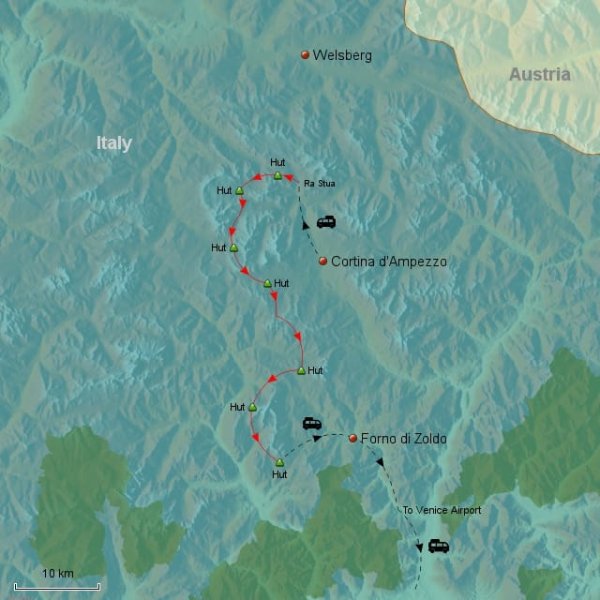
Self-Guided Dolomites Hut Hike
Hike the Italian Dolomites Hut-to-Hut on the Alta Via 1
Jump to:
Trip Summary
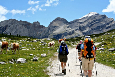
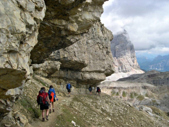
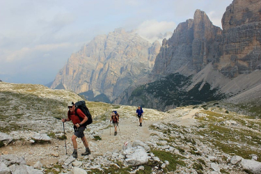
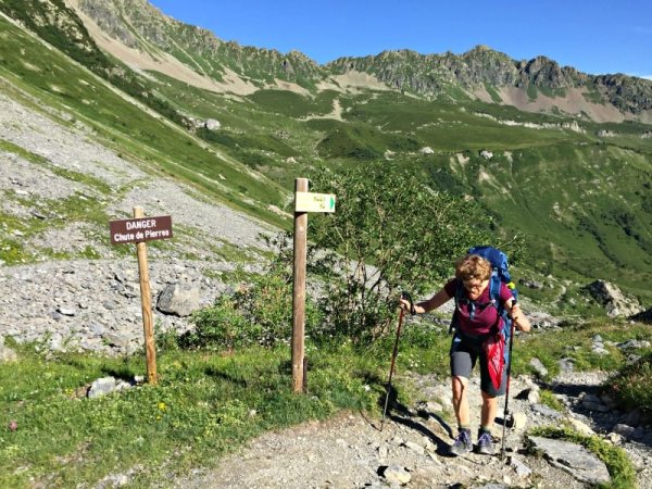
From soaring rock towers to grassy alpine meadows the Italian Dolomites offers some of the most dramatic, exciting and challenging hiking areas in the Alps. Strikingly different from the French or Swiss Alps, the limestone Dolomites rise dramatically from narrow valleys to form impressive spires, canyons, 3,000′ sheer rock walls, and huge limestone plateaus.
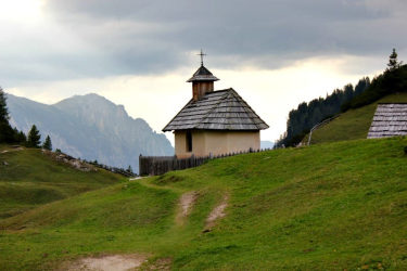
The Dolomites were once submerged under a coral sea, which led to the gradual formation of layers of sediments: limy mud, sand silt, clay. These elements combined with massive forces of the earth’s shifting crust and resulted in the formation of the Dolomites. Since that time, many, many millions of years ago, the Dolomites have been worn to their present state by glaciation, erosion, frost, wind, and rain. More recently in social history, this region saw heavy fighting during World War I and remnants of this are still very apparent. Three languages are spoken in this area: German, Italian, and Ladin, an old dialect, which came to the area from northern regions.
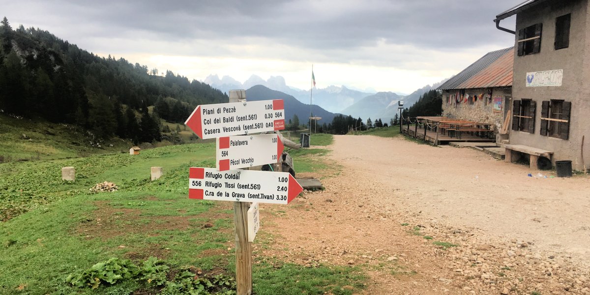
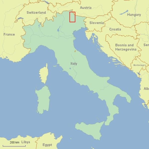
Beginning in the Italian Sud Tirol, the hike leads south along the high route, Alta Via 1, through the Pragser, Tofana, and Civetta mountain groups. The impressiveness of the scenery and the variety of terrain on this route is matched only by the warmth and hospitality offered by the mountain huts. The unusual contrasts in landscapes, changing colors and textures of the mountains and a curious mix of Italian and Austrian influences mean fantastic hiking, stunning scenery and plenty of pasta.
This linear trip is a great hike highlighted by breathtaking views, rustic and lively mountain refuges, a sense of excitement of what lies around the next bend or the next pass, and the satisfaction of traveling by foot through this beautiful and remote area.
Self-Guided Dolomites Hut Hike Itinerary


Additional Information
INCLUDED
This may vary depending on a finalized itinerary:
- General consulting regarding hiking dates and abilities
- Travel information on getting to and from the starting point
- Travel suggestions
- Maps: Italian Tabacco Maps; the 1:25,000 scale covering the route
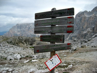
- Detailed trail notes, which include additional information covering various aspects of your trip (i.e., lunches, laundry, water, refuge routines, alternate transportation, etc.)
- We make and prepay all overnight accommodations, which include breakfast
- Most dinners
- We make and prepay all private taxi transfers as detailed in the final itinerary
- Hotels with private baths. Other overnight accommodations will vary
- Lots of great hiking
NOT INCLUDED
This may vary depending on your finalized itinerary: Airfare, lunches, travel to and from starting point/ending point, transfers or excursions on trains, lifts, buses, taxis, extra charges due to changes in itinerary, items not on set dinner menu, beverages (except what is served at breakfast), bottled water, insurance, extra costs, if any, for parking a personal car, items of a personal nature (phone calls, shower tokens, laundry, excess baggage charge, medical expenses, evacuation costs, insurance, passport fees, etc.). Allow roughly $200 – $350 in additional costs depending on your finalized itinerary.
LUGGAGE
This hike is not vehicle supported. You will need to carry a moderate-sized pack with all the clothing and accessories you will need for the duration of the hike. (See our sample packing list.) With advances in synthetic clothing and other travel gear, it’s possible to keep your pack weight to from 15 to 20 lbs., including lunch and water. Any extra luggage will be transferred as detailed in the final confirmed itinerary.
ACCOMMODATIONS AND FACILITIES
Hotels: The hotels are warm, welcoming and comfortable. All the rooms have private baths
Rifugios: The rifugios vary greatly depending on where they are located, but are usually simple and rustic, yet comfortable. Some accommodate as few as 20 hikers; most serve 30 – 50. They have bunk rooms with 2 – 8 bunks per room with blankets and pillows. The facilities are shared and there is a hot shower or two available. There are common dining areas, where meals are served. Please note: not all rifugios have private rooms.
Meals: Breakfasts and dinners are served at the hotels or rifugios and lunches are picnic style along the trail.
TRAVEL
Travel to Cortina: The Cortina Express Bus www.cortinaexpress.it and AVTO Bus www.atvo.it operate direct buses from Venice to Cortina. Go to the websites for schedules and more information. The bus takes about 2 – 3 hours. Or you can take a train from Venice to Calalzo Pieve di Cadore and then a bus or taxi to Cortina: travel time is about 3 – 4 1/2 hours, depending on the schedule. It is also possible to take a taxi from Venice to Cortina; though not the most economical, it is certainly the most convenient.
Travel to Welsberg: You can reach Welsberg/Monguelfo by train from Venice, Milan, Munich or Zurich, where there are major international airports. Venice is normally the best arrival airport. It is roughly 4 – 5 hours by train from Venice to Welsberg/Monguelfo.
WHO WOULD LIKE THIS TRIP?
Our Self-Guided Dolomites Hut Hike is great for hikers who look forward to wonderful, challenging hikes and like the thought of staying remote but comfortable rifugios. Some nights at the rifugios (though not all) include private rooms. This hike should be on every hiker’s list of musts!
WHAT MAKES FieldHouse Adventures’ TRIPS DIFFERENT?
We are a small company. As founders and guides, we have personally developed and hiked most of our itineraries. Having offered our hut-to-hut trip in the Dolomites, along the Alta Via 1, for over 20 years, we have extensive experience in the area and have established longstanding relationships with hotels and rifugios along the route. For our self-guided trips, we personally speak with prospective hikers and work closely to develop customized itineraries. We cover all of the details and provide you with everything you need to hit the trail confident of having a safe and rewarding experience. We are committed to creating quality hiking and walking experiences at good value. We are more than happy to put you contact with past participants if you’d like to hear about their experiences hiking with FieldHouse Adventures.
MORE INFORMATION
If you would like to register, or to receive more information or a detailed itinerary (including elevation gains, loss, and distance), please contact us. We’re also happy to supply a list of past participants willing to share their insights into the self-guided Dolomites Hut Hike experience.
 Self-Guided Across the Berner Oberland Hike
 Self-Guided Hikes in Switzerland
 Self-Guided Provence Inn-to-Inn
 Self-Guided Tour du Mont Blanc Hike