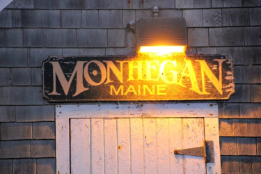
Day 1: Portland, Maine, to Monhegan Island
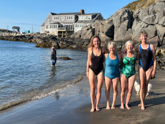
Morning pick-up at Portland International Jetport. After gathering as a group, a two-hour scenic drive up the coast will bring us to the fishing village of Port Clyde. We’ll stop for lunch at a wharf-side diner before catching the ferry out to Monhegan. Once on the island, we’ll have time to settle into our accommodations, take a walk around the village, or just relax on the porch and enjoy the evening. Area orientation and welcome dinner.
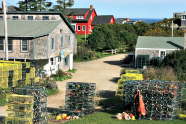
MONHEGAN: Of the more than 1,200 islands that dot Maine’s coast, Monhegan Island is considered especially captivating. Located 11 miles offshore, measuring 1½ miles long and a ½ mile wide, Monhegan rises like a whale out of the ocean. Monhegan’s current year-round population of around 75 is a mix of artists and fishermen. In the summer, the population swells to almost 1,200, as the Island attracts vacationers, bird watchers, and anyone looking to experience the peaceful setting created by island life. With 17 miles of hiking trails, there are a variety of options from which to choose, some passing through woods and some following along high cliff tops, rising a dramatic 160 feet above the shore. Dinner and breakfast included.
Day 2: Day Hike on Monhegan
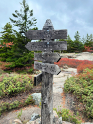
A cluster of grey-shingled houses, the village of Monhegan cloaks the harbor on the east side of the island. There are no paved roads. Aside from a few village pickup trucks, golf carts are the main form of transportation for the locals. The remaining two-thirds of the island is a nature preserve managed by Monhegan Associates. With 17 miles of trails crisscrossing the island, there is a variety of hiking and walking options from which to choose. The trails are numbered and well-trodden.
Hiking Options
-
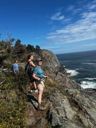
- The Cliff Trail #1 circles the island taking in the headlands of Burnthead, Whitehead, and Blackhead. This varied and rugged trail passes through forests and long rocky overlooks as it hugs the coast. Skirting Lobster Cove on the southern tip of the island, a popular area for birdwatching and site of the shipwreck tub boat the T.D. Sheridan, the trail climbs to headlands and dips down to rocky coves as it offers expansive ocean views.
Elevation gain: 942’; Elevation loss: 942′, Distance: 5.25 miles; Time: 3 hours.
- Cathedral Woods – Whitehead – Monhegan Lighthouse – Many trails cut across the island, making any number of shorter circular walks possible. A particularly enchanting walk is along the Cathedral Woods trail that winds its way through a stately spruce forest. It’s been a tradition among island children, young and old, to build Ferry Houses in these woods. Joining the Long Swamp trail, the path emerges on the high bluff of Whitehead with views down the shoreline to the cliffs of Blackhead and out to sea. The Whitehead trail returns via the lighthouse that sits on a hill overlooking the village.
Elevation gain: 240’; Elevation loss: 240′; Distance: 2 miles; Time: 1 – 1½ hours.
Around the Village
-
- Artist Studios: Artists have long been drawn to Monhegan, among them George Bellows, Rockwell Kent, Edward Hopper, and three generations of the Wyeth family. Many of Monhegan’s resident artists open their studios to the visiting public. It’s possible to spend a couple of delightful hours wandering from studio to studio, talking with artists and admiring their work. In town, The Lupine Gallery also has a nice representation of local work.
- Other points of interest on the island are the tiny Monhegan Library, the one-room schoolhouse, the island Ice Pond and Lighthouse constructed in 1824 set on a hill above the village. The Monhegan Museum of Art and History occupies the former lightkeepers house and is open seasonally.
Day 3: Transfer from Monhegan Island to Camden – Day hike and explore the area
It’s back on the ferry again for our return voyage to Port Clyde. From Port Clyde, it’s about a 40-minute drive up the coast to Camden. We’ll have the next day and a half to hike and explore the area.
ROCKLAND: 30-minutes up the coast from Port Clyde is the town of Rockland. Before the days when the automobile and highways were king, Rockland was a thriving harbor integral to the granite, lime, fishing, and boatbuilding industries. As these industries have faded, the art scene has flourished in Rockland anchored by the Farnworth Museum. Today, galleries, cafes, restaurants, and shops line its main street.
Hiking/walking Options
-
- Rockland Breakwater – The Rockland Breakwater extends almost a mile from shore, providing extra protection to the harbor from storms. Construction was begun in 1881 and completed in 1899 using 700,000 tons of granite quarried from local islands. The Rockland Breakwater Lighthouse at the end of the breakwater was built in 1902. Though it is no longer manned, it is still functioning. Walking time is about 1½ hrs round trip.
Elevation gain: 50’; Elevation loss: 50′; Distance: 2.1 miles; Time: 1½ hour.
- Beech Hill Preserve – The conservancy property managed by the Coastal Land Trust is about a 10-minute drive from the center of Rockland. A relatively easy walk up through blueberry fields to the top of Beech Hill provides classically beautiful views of Indian Rock Lighthouse and Penobscot Bay. Picturesque Beech Nut, a stone cabin with a sod roof, crowns the hill.Elevation loss: 200′; Distance: 1½ miles; Time: 1 hour; or if starting at Erickson Field, 5 miles, 2½ hours.
- Beauchamp Point – This walk begins at the water’s edge at the Rockport Harbor and Marine Park, the site of the Historic Lime Kiln area, and the commemorative statue of Andre the Seal. The walk wanders through the village of Rockport, along Beauchamp Point with views of the harbor and Penobscot Bay, past the Children’s Chapel, and finally scenic Aldermere Farm home of our beloved Belted Galloway cows, also affectioning known as Oreo cows.
Elevation gain: 250’; Elevation loss: 250′; Distance: 3 miles; Time: 1-2 hours.
Day 4: Day Hike in the Camden Area – Schooner Olad
CAMDEN: Like many coastal villages, Camden’s heritage is connected to the sea. Shipbuilding and provisioning as well as fishing were the backbones of its economy. Equally important were the six mills that operated along the Megunticook River at the turn of the century. During the 1880s, Camden became a popular summer destination for prominent families from Philadelphia, Boston, New York, Chicago, and Washington, DC. Today, 19th-century homes still line Camden’s High Street, and, while shipbuilding and woolen mills are things of the past, the harbor remains a thriving center of boating. Over the years some of the mills have been repurposed, and cool summer sea breezes are still beckoning visitors from “away.”
There are many great hiking and walking options in and around Camden. Camden Hills State Park, with over 30 miles of hiking trails, offers a great variety of hikes with ocean views, thick forests, lakeside cliffs, and open summits covered in wild blueberries.
Hiking Options
-
- Bald Rock Trail – Starting in the State Park near the town of Lincolnville, the Bald Rock Trail leads to its summit’s rocky ledges with stunning views of the island of Islesboro and the mountains of Blue Hill and Cadillac in the distance.
Elevation gain: 833’; Elevation loss: 833′; Distance: 3.4 miles; Time: 2 – 2½ hours.
- Mount Battie – In 1897 Columbus Bushwell of Camden engineered a carriage trail to the summit of Mount Battie and later built the Summit Hotel in 1898. During Camden’s carriage trade days at the turn of the century, the hotel was a popular destination but was torn down in 1916 as those days waned. The stone tower that crowns Mount Battie was erected in 1918 and vestiges of carriage trails remain. A short hike up one of these old carriage trails leads to the summit of Mount Battie will give us the iconic view of Camden and Rockport Harbors, as well as the islands and coastline from Owls Head to Cadillac Mountain in Acadia National Park.
Elevation gain: 564’; Elevation loss: 564′; Distance: 2.4 miles; Time: 1½ hours.
- Ocean Overlook – A longer hike with access via the carriage trails, the route up to Ocean Overlook diverges from the trail to Mount Battie. With a few short, steep, rocky sections this hike offers equally expansive views of Penobscot Bay and a great picnic spot atop the open, rock outcropping of the overlook.
Elevation gain: 961’; Elevation loss: 961′; Distance: 3.3 miles; Time: 2½ – 3 hours.
Other Activities
-
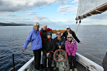
- Schooner Olad: A visit to Camden would not be complete without getting out on the water. We’ll take a sail on one of its famous schooners, the Schooner Olad. Built in 1927, this 47-foot schooner has been sailing the waters off Camden since 1985. Owner and skipper Captain Aaron Lincoln, a local Mainer, talks about the history of the area and the schooner trade as we sail through one he’s best-loved corners of the world. Out on the Olad, we will have the opportunity to breathe that fresh sea air, cruise Penobscot Bay, and experience the beautiful coast of Maine from the water. The schooner trip is weather-dependent – fog, rain, storms, high winds, etc. may result in the cancellation of the schooner sail.
- Camden is a pleasant village to explore and poke around. At the northern end of Camden’s main street at the head of the harbor is the Amphitheatre and Public Library. Designated a National Historic Landmark in 2013, the amphitheater was designed by the renowned landscape architect Fletcher Steele and constructed between 1928 – 1931. Between 1928 and 1935 Harbor Park, across from the amphitheater, was designed and developed by the Olmsted Brothers, whose father designed Central Park among other spaces.
Day 5: Camden to Mount Desert Island
We will begin the day with a drive to Mount Desert Island, leaving after breakfast and traveling “Downeast” along the coast. We will arrive by lunchtime, with plenty of time for an easy afternoon hike.
MOUNT DESERT: Mount Desert is the second-largest island along the eastern seaboard of the US, and the largest island along the Maine coast. It’s thought the island got its name when French explorer Samuel de Champlain described it as L’Isle des Monts-déserts, the island of barren mountains.
About half of the island is a national park. Established first as a National Monument in 1916 by Woodrow Wilson, Acadia was designated a national park in 1919, though at the time it was called Lafayette National Park. The name was officially changed to Acadia in 1929 and today encompasses 49,052 acres. Wanting to travel by carriage and avoid motor cars, between 1915 -1933, John D. Rockefeller Jr. develop a 57-mile network of carriage roads on the island and donated 11,000 acres to the park. The carriage roads still provide a wonderful way to experience the island hiking, walking, or biking.
Hiking Options
-
- Jordan Pond and South Bubble – The walk around Jordan Pond to South Bubble and Bubble Rock offers outstanding views of Jordan Pond to the south, Eagle Lake to the north, many of the surrounding mountains, and, of course, the Atlantic Ocean. It is a nice combination of easy walking alongside Jordan Pond and climbing steep, granite steps leading to the open summit of South Bubble, where we’ll see the precariously set Bubble Rock.
Elevation gain: 486′; Elevation loss: 486′; Distance: 3.4 miles; Time: 1¾ hours.
- Asticou Azalea Garden – Another option is a walk through the Asticou Azalea Garden. Inspired by native plant species and Japanese garden design, this is a “wonderful blend of East and West.” From here, a path climbs up through the Asticou Terraces with viewpoints to enjoy along the way. The path leads to Thuya Garden, a 140-acre preserve and the former home of Joseph Henry Curtis, a landscape architect from Massachusetts who summered here. The natural beauty and design of these gardens are awe-inspiring. From here it is possible to continue to the summit of Eliot Mountain overlooking the quaint village of Northeast Harbor.
Elevation gain: 140’; Elevation loss: 140′; Distance: 1-mile roundtrip, Time: 40 minutes. Mt Eliot extension: Elevation gain: 314’; Elevation loss: 314′; Distance: 2 miles; Time: 1 hour.
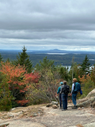
Day 6 & 7: Hikes in Acadia National Park
There are many great hikes on Mount Desert ranging from easy to strenuous. Those described below are just a few.
Hiking Options:
-
- Cadillac Mountain via the South Ridge Trail – Another scenic route is to the summit of Mount Desert’s highest mountain, Cadillac (1,525’) along the South Ridge Trail. Beginning in a dense forest, the route climbs somewhat gently to the open granite ridges that lead to the top of Cadillac Mountain. During fall and winter, this is where the first sunlight shines on the east coast of the United States. With a road to the top, it can be quite busy when we reach the summit with its panoramic views. On a clear day, it’s possible to see Katahdin to the north and Nova Scotia to the east.
Elevation gain: 1548’; Elevation loss: 1548′; Distance: 6.71 miles; Time: 3-4 hours.
- Beech Mountain Fire Tower and Valley Loop – A hike on the “quiet side” of the island, this is a more moderate hike along forest trails with views of Long Pond, Echo Lake, and the surrounding area. At the summit is a nationally registered historic fire tower, which may or may not be open.
Elevation gain: 479’, Elevation loss: 479’, Distance: 2.3 miles, Time: 2 – 2½ hours.
- Gorham Mountain and Ocean Path Loop – A moderate hike with great variety, this route begins at Sand Beach and follows the coastline past the crashing waves of Thunder Hole and then climbs to the summit of Gorham Mountain offering incredible panoramic views of Mount Desert, Frenchman Bay, and the other islands.
Elevation gain: 597’; Elevation loss: 597’; Distance: 3.1miles; Time: 2½ – 3 hours.
- Parkman Mountain to Gilmore Peak Loop – The Parkman Mountain / Gilmore Peak offers a variety of hiking on carriage trails, hiking trail, and opportunity to adapt the day with less/more mileage. This hike includes lovely vistas on bald peaks.
Elevation gain 921’, Elevation loss 921’, Distance: 3 – 5 miles depending on route, Time: 2 – 3 hours.
Also on Mount Desert:
-
- Acadia’s Historic Carriage Roads: 45 of 57 miles of carriage road on Mount Desert are within the national park. As well as walking, biking can be a great way of experiencing these wonderful roads and exploring the island.
-
- Abbe Museum: The Abbe Museum of Wabanaki art, history, and culture, is the first and only Smithsonian Affiliate in the state. With two locations, one in Bar Harbor and the other at Sieur de Monts Spring, the museum offers ongoing exhibits as well educational programs. Founded in 1926, the Abbe’s collections now represent 12,000 years of Native American culture and history in Maine.
-
- Wendel Gilley Museum in Southwest Harbor honors the legacy of prominent wood-carving artist Wendel Gilley through promoting artistic creativity and engagement with the natural world. The museum serves as a community center offering art exhibits as well as educational programs.
Day 8: Acadia National Park to Portland
We will depart our hotel after breakfast at about 9:00 am for Portland’s International Jetport, a 3-hour drive give or take. Depending on traffic we will arrive at the Jetport between 12:00 and 1:00 pm.

 Home
Home Reserve a Guided Trip
 Reserve a Self-Guided Trip
 Destinations
 Taking a Trip
 About Us
 Contact Us
 Blog
Blog (888) 845-5781
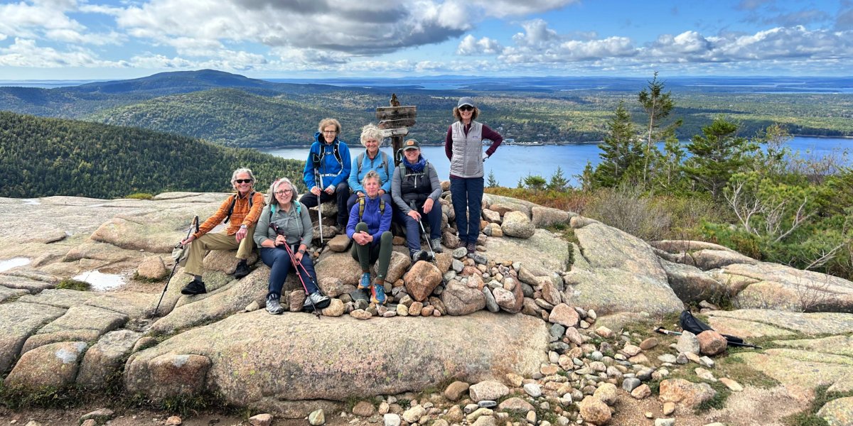
 Austria Cross-Country Skiing
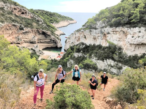 Croatia’s Dalmatian Coast – Walking Tour
Exploring World Heritage National Parks and Island Archipelagoes
Croatia’s Dalmatian Coast – Walking Tour
Exploring World Heritage National Parks and Island Archipelagoes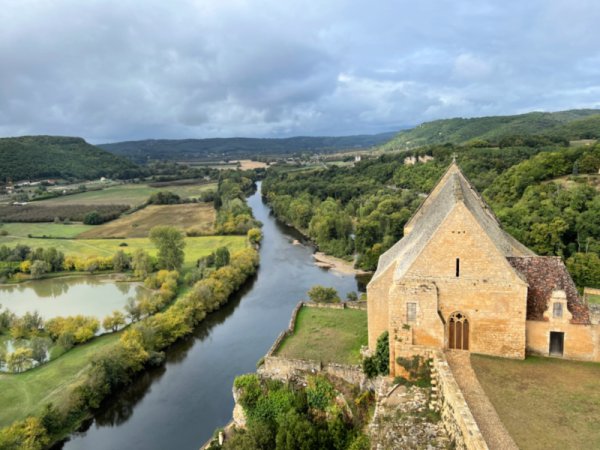 Dordogne on Foot – France Walking Tour
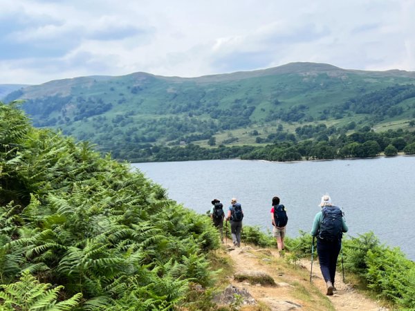 The Dales to the Lakes