
 Home
Home Reserve a Guided Trip
 Reserve a Self-Guided Trip
 Destinations
 Taking a Trip
- Trips Overview
- Trips Preparation
- Trips Overview
 About Us
 Contact Us
 Blog
Blog (888) 845-5781
Norway Inn-to-Inn
Hike the Peer Gynt Trail and Lusterfjord
Jump to:
Trip Summary
This 11–day trip is a combination inn-to-inn and hotel-based trip to two of Norway’s most classically beautiful areas.
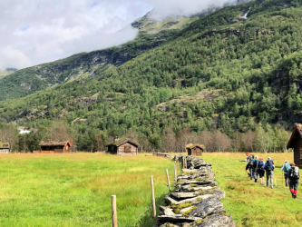
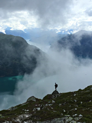
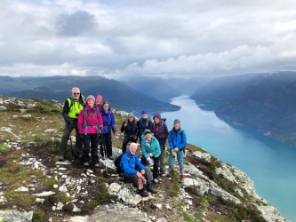
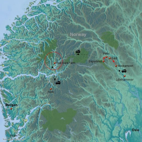
Our trip will begin in the central Gudbrandsdalen Valley, between Lillehammer and Vinstra, in southeast Norway. Surrounded by the National Parks of Rondane, Jotunheimen, and Dovrefjell, this is “Peer Gynt’s Kingdom,” named for Henrik Ibsen’s legendary Norse folk hero. A stunning area of sparkling lakes, rich forests, open moorlands, and expansive mountain vistas, this is the region where the folk character Peer Gynt was born and the place that inspired Ibsen to turn the folk tale into his epic play. Starting in Skei and ending in Espedalen, we will hike the 40-mile length of the Peer Gynt Trail, each night stopping at a variety of comfortable, classic Norwegian mountain lodges. Peer Gynt may well have been a boaster and a dreamer, but experiencing these landscapes on foot will convince you that he had good reason.
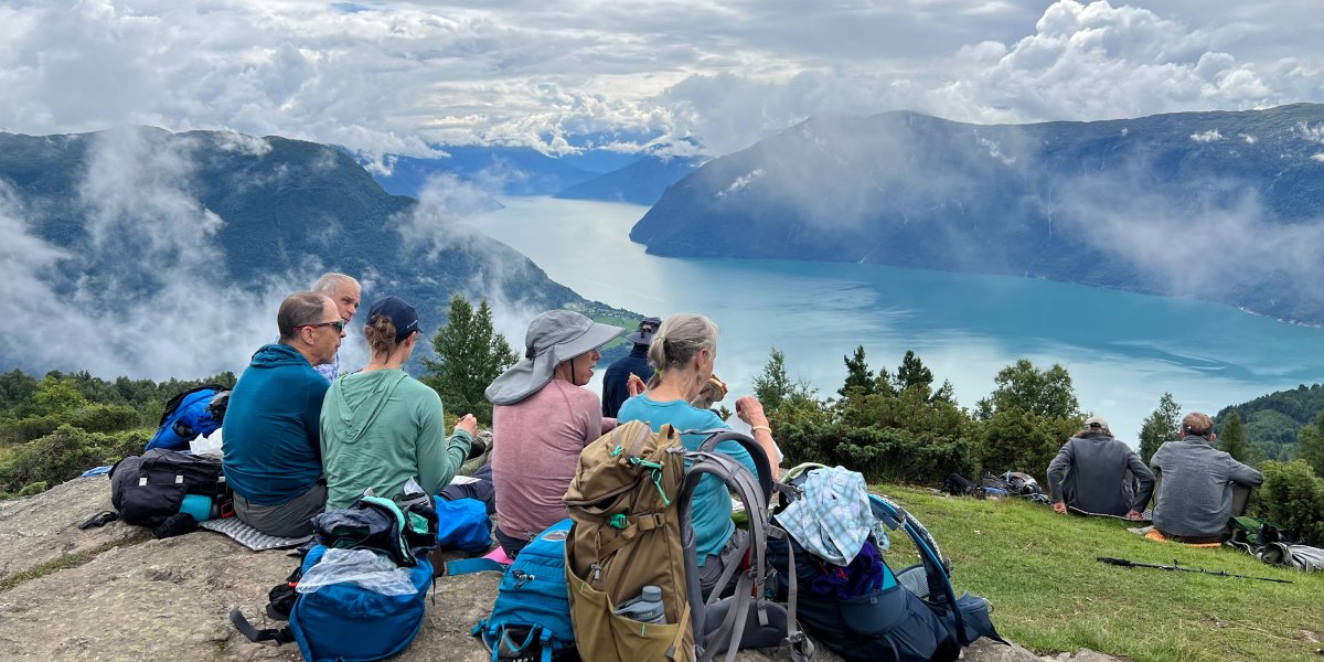
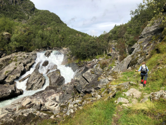
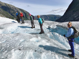
The second part of our trip will be based at the Nes Gard Guesthouse on Lusterfjord, the innermost arm of the 125-mile-long Sognefjord, the longest fjord in the world. Nes Gard sits across the fjord from the Feigumfossen, one of the highest waterfalls in Norway. With magnificent views of the mighty Hurrungane Mountains in western Jotunheimen and access to the Jostedal glacier to the north, this area has many hiking and mountaineering opportunities. Our hikes will take us up luxuriant green valleys with roaring waterfalls, across highlands with panoramic views, and up fjord-side hills with breath-taking views of the fjords. We will hike by summer farms, isolated homesteads, and visit cultural sites including the Urnes Stave Church, the oldest stave church in Norway, and a UNESCO Heritage site.
For anyone who is intrigued by Norway the pristine beauty and its enduring outdoor ethic, our Norway Inn-to-Inn trip is one for your bucket list.
Norway Inn-to-Inn Itinerary
Additional Information
SOLO TRAVELERS
If you wish to have your own room, there is a single room supplement fee of $800. Please let us know at the time of registration if you would like a single room. Single rooms are limited.
If you are traveling alone and would like to share a room, we will match you with a roommate. If there is no one with whom you can share, a “forced” single” fee of $600 will apply.
INCLUDED
- All accommodations
- All breakfasts, lunches, and dinners
- Entrance to Maihaugen outdoor museum in Lillehammer
- Entrance Breheimsenteret Glacier Center
- All group transportation as described in the itinerary
- Discover Norway guide – Peer Gynt Trail
- Nes Gard local guide
- FieldHouse Adventures guide
- Great hiking and wonderful memories!
NOT INCLUDED
Airfare, guided glacier walk, optional/individual transfers or excursions, items not on set dinner menu, beverages, personal items, tips to guides.
LUGGAGE
During the inn-to-inn segment of the trip, our luggage will be transferred ahead to our night’s accommodations. Our luggage will be transported with us to our hotel at Nes Gard. This means you will only need to carry a daypack with those items you will need during the day’s hike. Having said that, we recommend you keep your luggage to a size that you can easily manage yourself, given that our accommodations may have narrow hallways and no elevators. See a sample packing list.
ACCOMMODATIONS AND FACILITIES
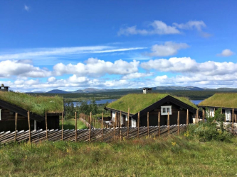
During the inn-to-inn section, Days 1–5, we will be staying in comfortable Norwegian mountain lodging. Rooms are double occupancy with private baths. Most have saunas and some have swimming pools. Typically, they are located in beautiful surroundings with good access to a variety of outdoor endeavors but do not offer much by way of shopping.
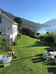
Days 6–10, we will be staying at Nes Gard Guesthouse, an 1850s farm that has been renovated to offer accommodations. The architecture and interiors are reminiscent of the period. Rooms are double occupancy with private baths.
MEALS
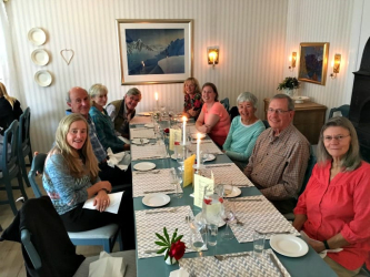
Breakfasts are buffet style and will usually include bread, cheese, breakfast meats and fish, cereal, yogurt, and hot beverages. Picnic lunches will be packed from the breakfast buffet (hotels will provide wax paper and plastic bags, or you can bring a reusable container).
Set dinners will be taken at the hotels. They will generally consist of a starter followed by a main course and dessert. Wine and beer will be available at an additional cost. The main course tends to be either meat or fish accompanied by potatoes and fresh vegetables. With advanced notice, we are happy to accommodate those with medically restrictive diets or vegetarians, and we will do our best to accommodate those with non-red meat or vegetarian preferences.
TRAVEL
It is easiest to fly to Oslo’s Gardermoen Airport. Trains leave directly from Gardermoen Airport for Lillehammer and take about two hours.
MEETING POINT
The trip will start at 1:00 pm on Day 1 at the Lillehammer Train Station. We will confirm the exact location and confirm the meeting time in the final information. The Lillehammer train station is small, so finding the group will not be a problem, and it is an easy walk to our accommodation at the Mølla Hotell.
ENDING POINT
The trip will end in Myrdal on the last day. After breakfast, the group will transfer to Flåm the morning of the last day. From Flåm, we travel together by train to Myrdal, where the trip officially ends. In Myrdal, individuals travel on their own to either Bergen or Oslo. Travel from Myrdal to Oslo is about 5 hours and about 2 1/2 hours from Myrdal to Bergen.
MORE INFORMATION
Please contact us for a more detailed itinerary, for more information, or to register. We’re also happy to supply a list of past participants willing to share honest insights into this guided Norway In-to-Inn experience.
Route Maps
Related Trips
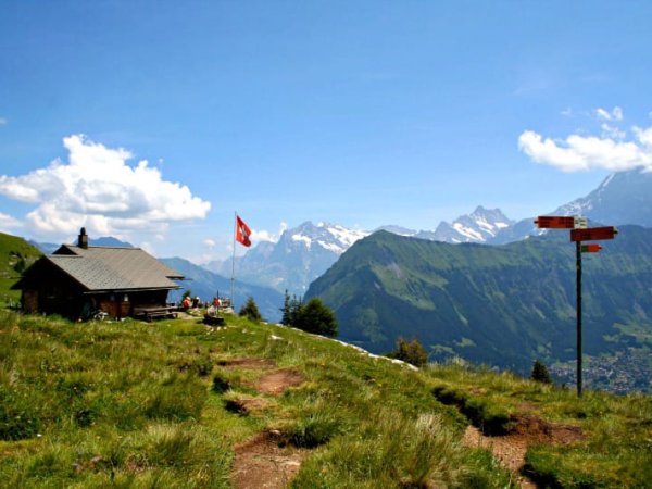 Across the Berner Oberland Hike
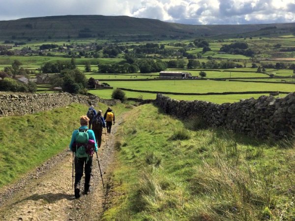 England Coast-to-Coast Walk
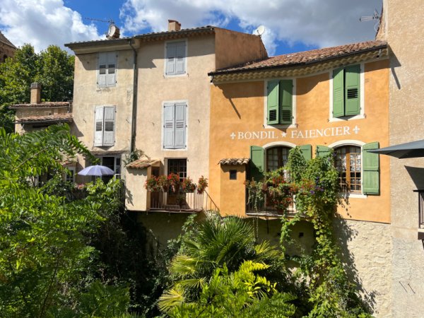 Hiking Provence Inn-to-Inn
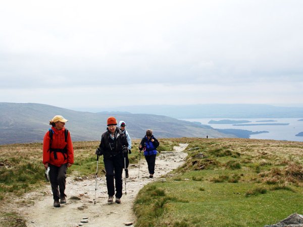 Scotland’s West Highland Way Hike
Scotland's classic long-distance route from Glasgow to Ben Nevis
Scotland’s West Highland Way Hike
Scotland's classic long-distance route from Glasgow to Ben Nevismore