-
 Destinations
-
 Taking a Trip
- Trips Overview
- Trips Preparation
-
 About Us
-
 Contact
-
 Home
Home
-
 Reserve a Guided Trip
-
 Reserve a Self-Guided Trip
-
 Destinations
-
 Taking a Trip
- Trips Overview
-
- Trips Preparation
-
-
 About Us
-
 Contact
-
 Blog
Blog
-
(888) 845-5781
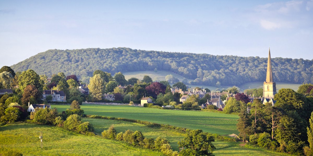
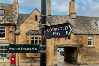
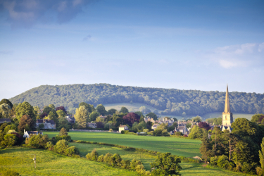
Hiking the Cotswold Way
An idyllic ramble through quintessential English countryside
Jump to:
Trip Summary
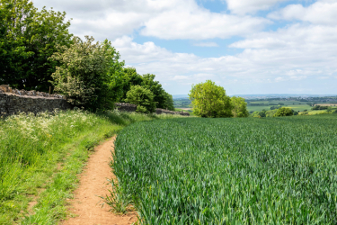
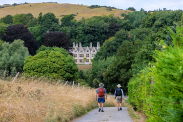
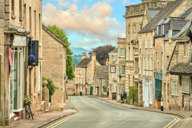
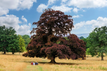
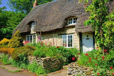
Following the western rim of the Cotswold Hills, the Cotswold Way is a 102-mile, long-distance walking route through some of England’s most idyllic landscapes. Beginning in the charming market town of Chipping Campden and ending in the historic Roman city of Bath, the route leads through rolling green pastures, shady beech woodlands, and into honey-colored villages built from Cotswold stone. It’s difficult to describe the route without using the word “quintessential.”
Conceived as a long-distance route in the 1950s and completely waymarked by the mid-1970s, the captivating nature of the Cotswold Way led it to be designated as a National Trail in 2007. The route offers almost everything one would hope for on a walk across the English countryside. We’ll hike through scenic farmland and atmospheric forests, into charming villages, and past 17th-century manor houses. We’ll feel the depth of history as the route skirts the sites of Iron Age hill forts, ancient battlefields, deserted abbeys, and whimsical follies. Each day our hikes up and along the escarpments of the Cotswold Hills will offer spectacular panoramic views. Welcoming pubs and comfortable inns are never far away.
You’re sure to be as enchanted by the beauty of the Cotswold as the numerous authors such as J.M Barrie, Jane Austen, J.R.R. Tolkien, Lewis Carroll, and T.S. Eliot who gravitated to the area. Aside from the beauty and variety the route has to offer, the Cotswold Way is a solid hiking and walking experience. The climbs up to and down from the escarpments can be steep and the days long. All in all, it promises to be a rewarding journey.
This was a new trip for us last year, and we can think of no one better to introduce you to these iconic landscapes than International Mountain Leader, Di Brooksbank. Di’s expert leadership, depth of experience, and local knowledge along with her boundless enthusiasm for grounding walkers in the world around them are sure to make this an unforgettable trip. We hope you’ll join us.
Hiking the Cotswold Way Itinerary
Additional Information
SOLO TRAVELERS
If you wish to have your own room, there is a single room supplement fee of $900. Please let us know at the time of registration if you would like a single room. Single rooms are limited.
If you are traveling alone and would like to share a room, we will match you with a roommate. If there is no one with whom you can share, a “forced” single” fee of $600 will apply.
- Note: Some of the smaller inns may only have a limited number of single rooms available. It may be on these occasions that those who have opted for single rooms may have to share.
INCLUDED
- All accommodations
- All breakfasts (full English)
- Most dinners
- All group transfers as described in the itinerary
- Daily luggage transfer
- Guide/s
- Great hiking and great memories!
NOT INCLUDED
Airfare, travel to Broadway on Day 1, onward from Bath on Day 11, lunches, optional/individual transfers between inns or individual excursions, items not on set dinner menus, beverages, insurance, tips to guides, items of personal nature (phone calls, laundry, excess baggage charge, passport fees, etc.).
LUGGAGE
This hike includes daily luggage transfers. You will only need to carry a small day pack with the clothing and accessories you will need for the day. We ask that each group member bring one medium-sized piece of luggage and recommend that you keep it to a size that you can easily manage yourself, given our accommodations may have narrow hallways and no elevators. See our sample packing list.
While this trip includes luggage transfer, it is not vehicle-supported. Participants should be in a physical condition appropriate to the strenuousness of this hike. It is, however, possible to skip a day of hiking and take a taxi to the next hotel. This extra cost is not included in the price of the trip.
ACCOMMODATIONS AND FACILITIES
Most evenings will be spent in small villages or hamlets. There may be limited choices of accommodations in some locations. Our accommodations will run the gamut from small, simple inns to very comfortable country hotels. All rooms will be double occupancy with private ensuite facilities. Breakfasts and dinners are served at the hotels or nearby restaurants or pubs. Lunches are picnic-style along the trail, with the occasional stop at a pub or tea room.
TRAVEL
It is most convenient to fly into London, England.
MEETING POINT
The group will meet at our hotel in Broadway on the evening of Day 1 at 6:30 pm for an area orientation, followed by our welcome dinner
ENDING POINT
The trip will end at our hotel in Bath on the morning of Day 11. There are frequent trains from Bath to London’s Paddington Station. Travel time is about 1 1/2 hours. Heathrow and Gatwick Airports can be reached by train from London. Travel time can be around 30 – 45 minutes.
WHO WOULD LIKE THIS HIKE?
The Cotswold Way is a great option whether you’ve hiked other routes in England or this is your first experience. Renowned for its natural beauty, villages built from local honey-colored limestone, and rich history, there’s no better way to experience the area than on foot. Each provides good solid hiking with the promise of comfortable accommodations and a hearty brew waiting at the end of each day. For fit walkers and hikers, this route through peaceful and timeless landscapes is sure to be rewarding.
MORE INFORMATION
If you would like to register, or would like to receive more information, including a detailed itinerary (including elevation gains, loss, and distance), please contact us. We’re also happy to provide a list of past participants willing to share honest insights into our trips.
Related Trips
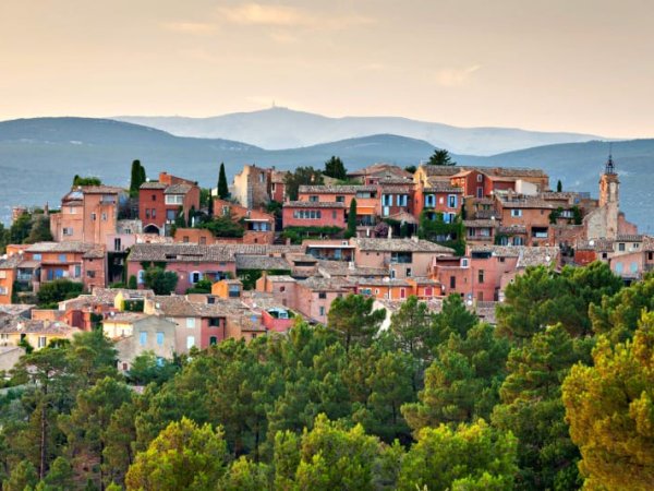 Colors of Provence Hike
 Hiking the Kumano Kodo
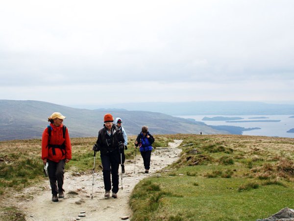 Scotland’s West Highland Way Hike
Scotland's classic long-distance route from Glasgow to Ben Nevis
Scotland’s West Highland Way Hike
Scotland's classic long-distance route from Glasgow to Ben Nevismore
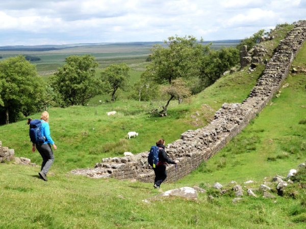 Walking Hadrian’s Wall Inn-to-Inn